ParkPal
Getting outside shouldn't have barriers.
UX Designer & Researcher · Capstone Project, University of Michigan School of Information
Every competitor used the wrong data model — binary 'accessible/not accessible' filters that couldn't capture reality. A paved path with a 12% grade is technically accessible but practically unusable for a wheelchair user. The opportunity wasn't building a better app — it was building the right data type.
People with mobility-related disabilities had no reliable way to understand whether a park or trail was actually accessible before visiting. Every competitor treated accessibility as a binary filter, not a data type.
I identified that the core product opportunity was building a planning tool that gives mobility-impaired users confidence to commit to a trip before leaving home — because discovering inaccessibility on arrival means a wasted trip with no fallback.
Task completion improved 40% between testing rounds. The product was recognized within the Michigan School of Information for its accessibility-first rigor.
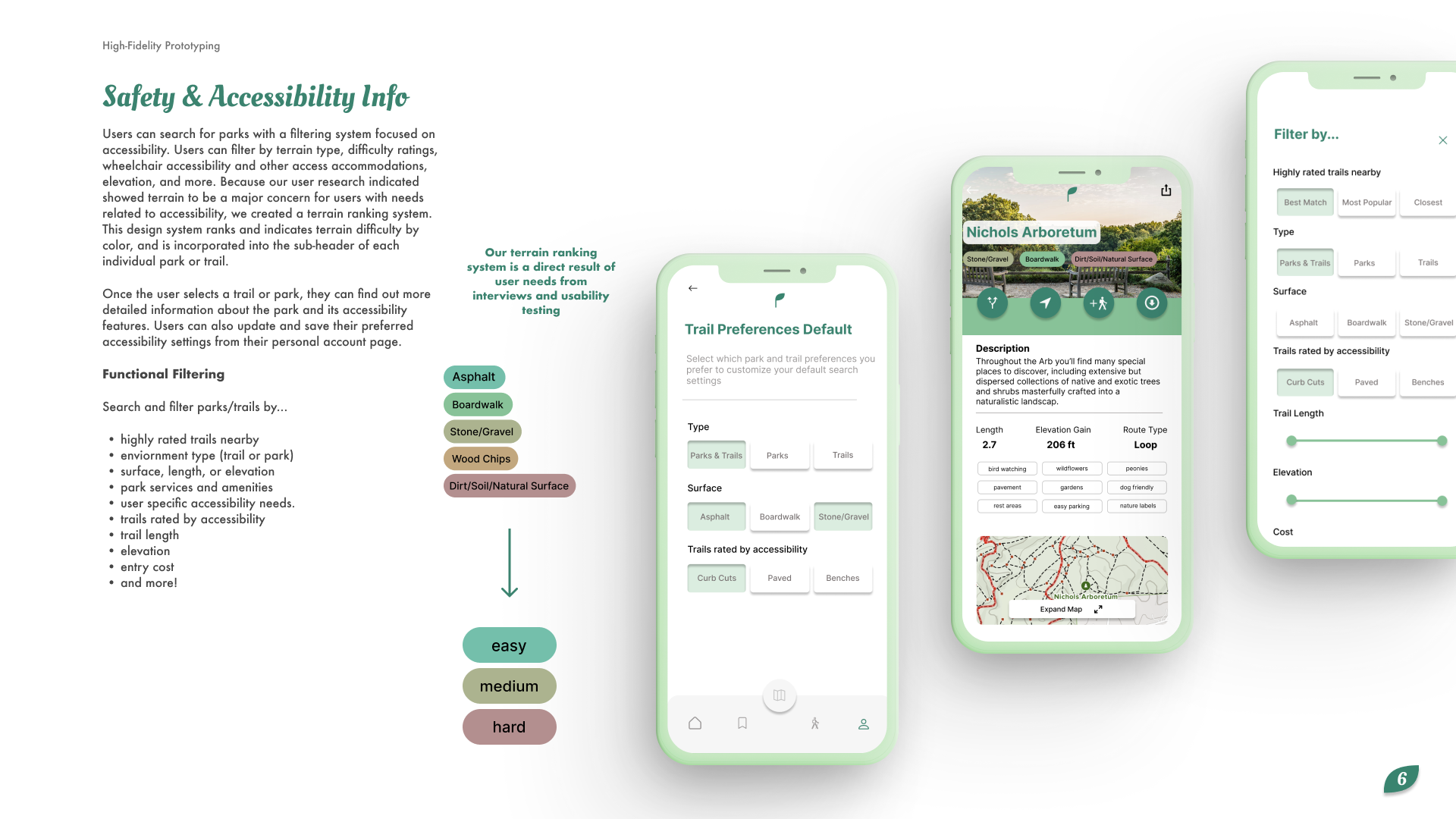
Accessibility as a graded score, not a checkbox
The trail detail view was designed around the insight that accessibility exists on a spectrum. Rather than filtering trails in or out, users see a graded accessibility score alongside surface type, condition, and grade — giving them the information to make their own judgment. Structured community input fields (not freeform reviews) keep that data reliable over time.
- 12 total sessions with elderly and mobility-impaired participants across 3 rounds
- Competitive analysis identifying every competitor uses wrong accessibility data model
- Defined core differentiation: graded, multi-dimensional accessibility scoring
- Designed structured community contribution system for crowdsourced trail conditions
- Two rounds of moderated usability testing with same participant pool (40% improvement)
- WCAG AA compliance throughout